
Geocomputation with R
Geocomputation with R is for people who want to analyze, visualize and model geographic data with open source software.
It is based on R, a statistical programming language that has powerful data processing, visualization, and geospatial.
- First published
- 2019
- Publishers
- Taylor & Francis Group
- Subjects
- Geographic information systems·Information storage and retrieval systems·Programming languages spatial analysis
Books
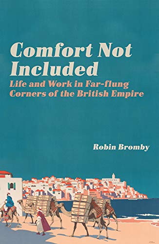
Comfort Not Included
Robin Bromby
Colonial officials posted to the gilbert islands were advised to employ a full-time fisherman—otherwise they would have no food.

Bloody Beth
Robin G. Mercier
Alien Hand Syndrome
Robin G. Mercier
Sleepy Head
Robin G. Mercier
Control
Robin G. Mercier
SuperMax
Robin G. Mercier
Sack Man
Robin G. Mercier
Relics
Robin G. Mercier
Love in the NHS
Robin Shohet
Love in the nhs shows how acts of caring, compassion, courage, kindness and excellence abound in the nhs.
Wolf
Robin G. Mercier
Going for Broke
Robin G. Mercier

Mark of Justice
Robin James
Spatial Planning in Germany
Robin Ganser
Relics
Robin G. Mercier
I'll Be Seein' Ya : a Play
Jon Robin Baitz
Storm on the Sea
Robin G. Mercier
Prehistoric Italy
Robin Skeates
Blackmailed
Robin G. Mercier
Accused
Robin G. Mercier
Pass CCRN(R) (Adult)
Robin Donohoe Dennison
Beyond Right and Wrong
Robin G. Mercier
Scroll of the Dungeon Master
Robin K. Miller
Beyond Right and Wrong
Robin G. Mercier
SuperMax
Robin G. Mercier

Geotechnical Risk and Reliability, an Introduction
Robin Chowdhury
Traditional methods of geotechnical engineering still dominate the approach of risk and reliability.

Strong Baby
Robin Arzón
Dr. Death
Robin G. Mercier
Mark of Justice
Robin James
Night and Day
Robin G. Mercier

Mark of Justice
Robin James
How Religion Evolved
Robin Dunbar

Class Interruptions
Robin Brooks
Walking in Tall Weeds
Robin W. Pearson
Bibliomaniac
Robin Ince
Global Citizenship Education for Young Children
Robin Elizabeth Hancock
From Idols to Icons
Robin M. Jensen
Targeted Heart
Robin Christine DeMarco
The Return of Christ
Robin Corner
Dice, Dragons, and Beyond
Robin K. Miller

"My Faith in the Constitution Is Whole"
Robin L. Owens
Night Shift
Robin Cook
Saving the Great Western Railway
Robin Jones
Mr. Penumbra's 24-Hour Bookstore
Robin Sloan
Sally Comet vs the Space Pirates
Robin Twiddy

Law of the Sea
Robin Churchill
Raising Humanity :
Robin Alexis
Living in a Stone Age Settlement
Robin Twiddy; Danielle Webster-Jones

Believer
Robin Brande
This book is about ghosts and gods and flying saucers; certainty in the absence of knowledge; how the stories we tell ourselves to deal with the distance between the world as it is and as we'd like it to be can stunt us or save us.
Engaging Place, Engaging Practices
Robin F. Bachin
Journey of the White Bear
Robin Youngblood
Law of the Sea
Robin Churchill
Talking to Terrorists
Robin Soans
Brighter by the Day
Robin Roberts
Similar books

Gis for Environmental Decision-Making
Andrew A. Lovett
Environmental applications have long been a core use of gis.
Indoor Positioning
Nel Samama
Provides technical and scientific descriptions of potential approaches used to achieve indoor positioning, ranging from sensor networks to more advanced radio-based systemsthis book presents a large technical overview of various approac.
Spatial Information and the Environment
Peter Halls
There is considerable current academic interest in the interface between geographical information systems (gis) and the environment.
Focus on Geodatabases in ArcGIS Pro
Allen, David W.
Focus on geodatabases in arcgis pro introduces readers to the geodatabase, the comprehensive information model for representing and managing geographic information across the arcgis platform.
Geocomputation with R
Robin Lovelace
Geocomputation with r is for people who want to analyze, visualize and model geographic data with open source software.
Geocomputation with R
Robin Lovelace
Geocomputation with r is for people who want to analyze, visualize and model geographic data with open source software.
Geospatial Data Science Quick Start Guide
Abdishakur Hassan
QGIS and Generic Tools
Clément Mallet
These four volumes present innovative thematic applications implemented using the open source software qgis.
Understanding GIS
Smith, David

Introduction to GIS Programming and Fundamentals with Python and ArcGIS®
Chaowei Yang
Combining gis concepts and fundamental spatial thinking methodology with real programming examples, this book introduces popular python-based tools and their application to solving real-world problems.

Geospatial Data Science Techniques and Applications
Hassan A. Karimi
Data science has recently gained much attention for a number of reasons, and among them is big data.

GIS and the Social Sciences
Dimitris Ballas
Gis and the social sciences offers a uniquely social science approach on the theory and application of gis with a range of modern examples.
Understanding GIS
Smith, David
Geospatial Data Science Techniques and Applications
Hassan A. Karimi
Data science has recently gained much attention for a number of reasons, and among them is big data.
Connected Mobile Experiences and Location Based Services
Darryl Sladden
GEOValue
Jamie B. Kruse
Basic GIS Coordinates
Jan Van Sickle
Coordinates are integral building tools for gis, cartography, surveying and are vital to the many applications we use today such as smart phones, car navigation systems and driverless cars.

Geocomputation
Robert J. Abrahart
A revision of openshaw and abrahart's seminal work, geocomputation, second edition retains influences of its originators while also providing updated, state-of-the-art information on changes in the computational environment.
New Lines
Matthew W. Wilson

Introduction to Geospatial Information and Communication Technology (GeoICT)
Rifaat Abdalla
This book is designed to help students and researchers understand the latest research and development trends in the domain of geospatial information and communication (geoict) technologies.
Smart Information Systems
Frank Hopfgartner
Progress in Cartography
Georg Gartner
Online GIS and Spatial Metadata
Terry Bossomaier
Esri Map Book
Environmental Systems Research Institute (Redlands, Calif.)
Atlas of cursed places
Olivier Le Carrer
Making Spatial Decisions Using GIS and Lidar
Kathryn Keranen
GIS Applications in Agriculture, Volume Four
Tom Mueller

Geo-Informatics in Resource Management and Sustainable Ecosystem
Fuling Bian
This volume constitutes the refereed proceedings of the second international conference on geo-informatics in resource management and sustainable ecosystem, grmse 2014, held in ypsilanti, mi, china, in december 2014.
Mediated Geographies and Geographies of Media
Susan P. Mains
This is the first comprehensive volume to explore and engage with current trends in geographies of media research.

Applied Geoinformatics for Sustainable Integrated Land and Water Resources Management in the Brahmaputra River Basin
Nayan Sharma
The central theme of this book is focused on the analyses and the results which emerged from the international research project brahmatwinn sponsored by european commission (ec) and conducted during 2006 2009.

Advances in Spatial Data Handling and Analysis
Francis Harvey
This book contains a selection of papers from the 16th international symposium on spatial data handling (sdh), the premier long-running forum in geographical information science.

Historical GIS Research in Canada
Jennifer Bonnell
Fundamentally concerned with place, and our ability to understand human relationships with environment over time, historical geographic information systems (hgis) as a tool and a subject has direct bearing for the study of contemporary environmental issue.

Geocomputation
Chris Brunsdon
This newly updated edition covers cutting-edge topics in computational geography, addressing a domain in both geographic and computer sciences.

Geographic information system
Jatin Pandey

GIS Tutorial for Python Scripting
Allen, David W.
Gis tutorial for python scripting uses practical examples, exercises, and assignments to help students develop proficiency using python(r) in arcgis(r) gis tutorial for python builds upon previously acquired gis skills and takes them to the next .
Advances in Spatial Data Handling and GIS
Anthony G. O. Yeh
Di li xin xi yuan shu ju fu wu jie kou gui fan
Guo jia ce hui di li xin xi ju (China)
Lining up Data in ArcGIS
Margaret M. Maher
Spatial Simulation
George L. W. Perry
Ji yu Excel de di li shu ju fen xi
Yanguang Chen

GPS/GNSS antennas
B. Rama Rao
Focusing on three principal systems - gps, galileo, and glonas - this book provides a treatment of gnss antennas.
Simulation of Complex Systems in GIS
Patrice Langlois
This book provides a comprehensive view of geographical modeling.
Spatial Interpolation for Climate Data
Hartwig Dobesch
Spatial Simulation
George L. W. Perry

Coastal hazards
Charles W. Finkl
Sponsored by the turbulence committee and the fluids committee of the engineering mechanics institute of asce.
Di zhi xin xi xi tong
Anbo Li
GIS Tutorial 2
Allen, David W.
Introducing Geographic Information Systems with ArcGIS
Michael D. Kennedy

Geo-Information
Mathias Lemmens
Geomatics, the handling and processing of information and data about the earth, is one geoscience discipline that has seen major changes in the last decade, as mapping and observation systems become ever more sensitive and sophisticated.

National Geographic 125 years
Mark Collins Jenkins
Featuring show-stopping imagery and thrilling behind-the-scenes tales, national geographic 125 years captures the heart of national geographic's fascinating history, from its earliest days as a scientific club to its growth into one of the world's .
Diversity of America
National Geographic Learning Staff
Geospatial InfoFusion II
Md.) Geospatial InfoFusion (2nd 2012 Baltimore

Introduction to Geographic Information Systems
Chang
Insel and roth, core concepts in health pioneered the concept of personal responsibility for health and individual behavior change back in 1976.

Teaching geographic information science and technology in higher education
D. Unwin
Geographic information science and technology (gisc&t) has beenat the forefront of education innovation in geography and alliedsciences for two decades.